
What does geology have to do with agriculture, you might wonder? Rocks don’t exactly grow like corn or cattle. Think about it for a minute, though. Geology includes more than just rocks; a region’s geology affects what kind of soil it has, what kind of topography it has, and what its water supply looks like.
The water supply is especially important for agriculture, of course. And things get tricky when farmers aren’t the only people who need to use the water supply. That’s what our clients in Ottawa County, Michigan were dealing with when they asked us to make a groundwater display.
(You can see more photos of the Groundwater Challenges Display on our custom products page.)
Geology and Groundwater
Ottawa County is both the fastest-growing county in Michigan and a hub of the state’s agriculture industry. It grows over 80,000 combined acres of corn and soybeans, and it’s Michigan’s top-earning county in terms of greenhouse products. Agriculture employs about 2,500 people across the county.
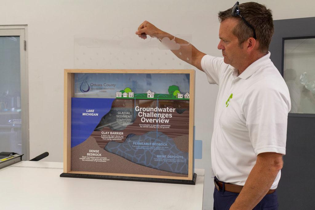
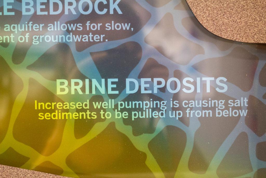
Ottawa County’s rural areas rely on groundwater, getting most of their water from glacial and bedrock aquifers. Unfortunately, Ottawa County’s geology includes an unusual layer of thick clay above the bedrock aquifer. This layer cuts the aquifer off from the fresh water in Lake Michigan, on one side. And on the other, it makes harder for fresh rainwater to refill the aquifer (which is what usually replenishes aquifers).
To add to the problem, as people pump more water from the aquifer, more minerals get drawn into the water. The increased saltiness means that the water isn’t as good for crops, and can even damage them.
To address the groundwater situation, Ottawa County’s government developed a water conservation strategy that includes plans for educating the public. Since most residents don’t know about the county’s geology, they needed a way to explain it clearly and easily. So, they asked us to create a display for their presentations.
Explaining Geology with a Groundwater Display
The display we designed uses several different layers to show the geological structures beneath Ottawa County. Two sliding panels, meanwhile, help Ottawa County’s leaders explain how the water cycle usually works — and how that cycle breaks down in most of Ottawa County.
The top panel features graphics of raindrops, to illustrate how rain soaks into the ground but gets cut off by the clay layer. A side panel, meanwhile, appears blue at first, but as you pull it out, the color transitions to yellow. This illustrates how lower water levels lead to increased brininess.
Using a clear visual depiction of the geology involved means Ottawa County’s leaders can help people understand the reasons for their water challenges and why the county’s management plan will help. As part of that plan, the display helps preserve enough water for everyone in the county — residents, businesses, and farmers.
